Los Angeles Tree Canopy Assessment and Prioritization
This study used high-resolution imagery and LiDAR data to map the urban tree canopy for all of Los Angeles County, providing a parcel-level spatial understanding of the areas of existing tree canopy as well as possible (i.e. biophysically feasible) locations where the canopy can be expanded. Using the Census Block Group as its unit of analysis, the study found that canopy varied widely across the county, ranging from 1% to 80% cover. Areas the most in need of tree canopy were located in northern and southeast parts of the county. Read our full LA Tree Canopy Report (2016) here.
CURes partnered with the non-profit TreePeople, the University of Vermont Spatial Analysis Lab, and Savatree Consulting Group to produce the analysis, with funding from the US Forest Service and CAL FIRE. This work built on a previous CURes-led tree canopy assessment of the LA County coastal zone.
Read the press release about the tree canopy study.
Explore the tree canopy of LA County using our Tree Canopy Data Viewer
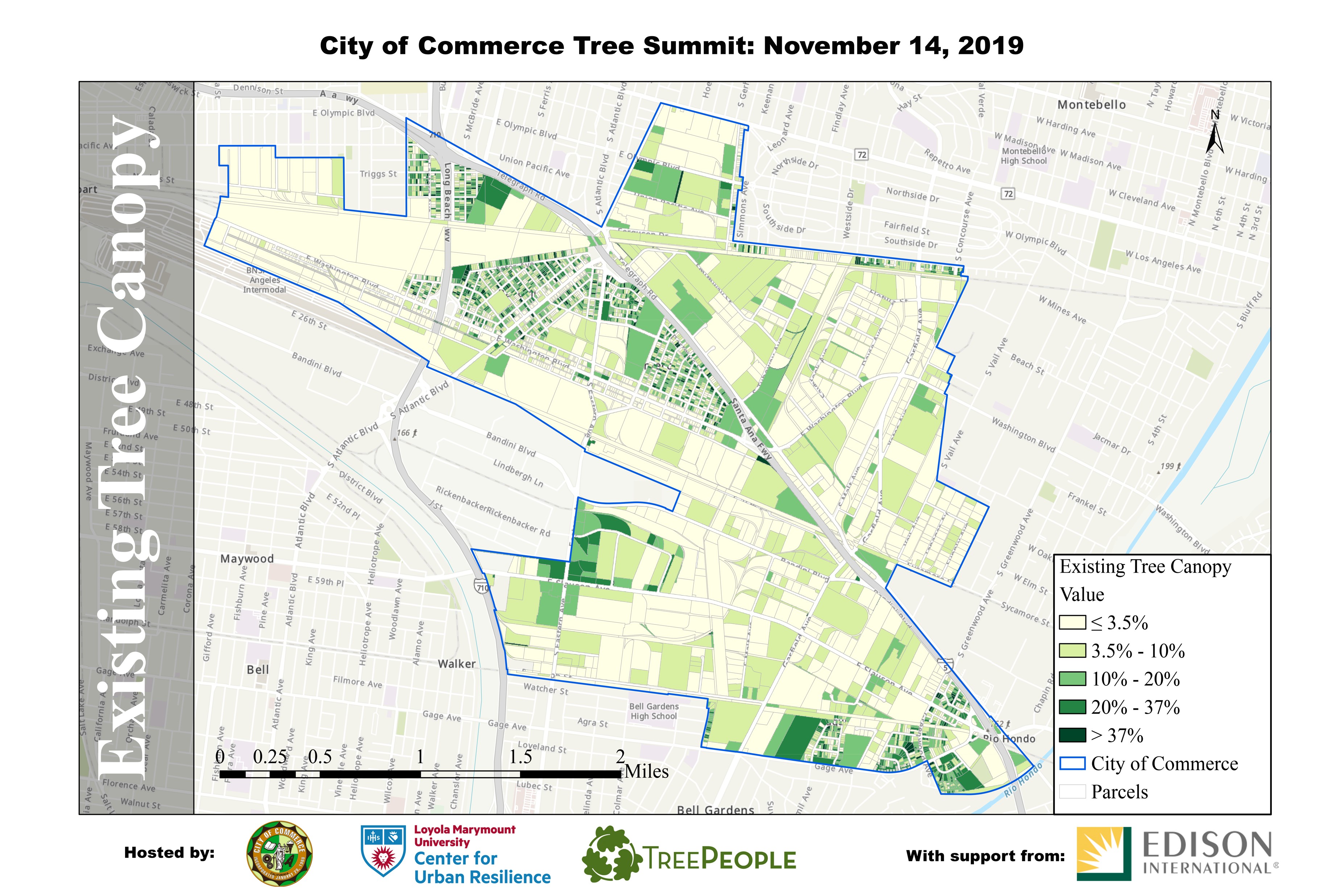
Gateway Cities Community-Based Tree Prioritization
The data from the LA County assessment provided valuable information on the extent and location of our urban forest canopy, which helped guide decision-making. Along with collaborators, CURes conducted community-based tree canopy prioritizations in Southeast Los Angeles County.