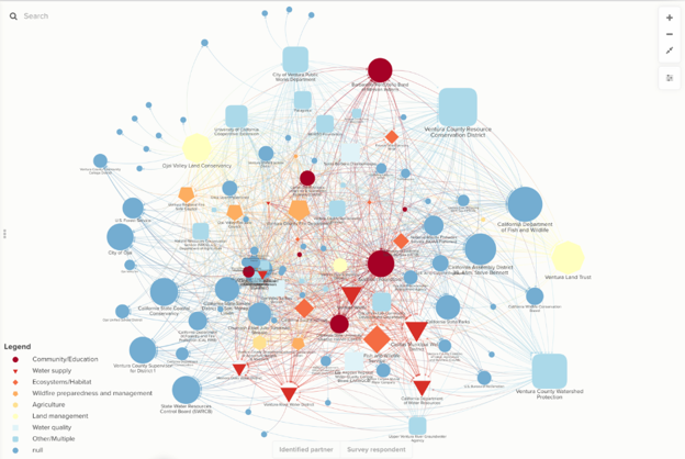
The Ventura River Watershed Resilience Project is one of five regional, community-driven efforts to strengthen watershed landscapes and networks to address water resource conservation and management in the face of a changing climate. These efforts are supported by the California Department of Water Resources’ Watershed Resilience Pilot Program. CURes partnered with the Ventura County Resources Conservation District, the Ventura Watershed Council, CSU Northridge Center for Geospatial Science and Technology, and the CSU San Bernardino Institute for Water Resiliency to apply the STEW-MAP methodology to assess the network of organizations working on water resilience in the Ventura River Watershed.
To view the results of our research and engagement efforts, please explore the Ventura River Watershed Network Assessment StoryMap.